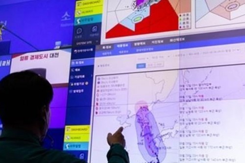
S. Korea braces for powerful Typhoon Khanun

Seoul, Aug 9 (IANS) South Korea is forecast to enter the influence of powerful typhoon Khanun on Wednesday, the first typhoon expected to make landfall on the country since Hinnamnor in September last year, the weather agency said.
Khanun was advancing northwest from the ocean 140 km southwest of Japan's Kagoshima at a speed of 14 km per hour as of 3 a.m., according to the Korea Meteorological Administration (KMA).
The typhoon may sustain its northward advance to reach waters 120 km south of the southern coastal city of Tongyeong at 3 a.m. on Thursday and make landfall in the country that morning, Yonhap News Agency quoted the KMA as saying.
When it reaches South Korea, the typhoon will remain "strong" in intensity, but its force may diminish slightly to "medium" by the time it is expected to brush near the central city of Cheongju at 3 p.m. on Thursday.
Khanun will then move further north to pass vertically through South Korea and reach 90 km south-southwest of North Korea's northern city of Kanggye at 3 p.m. on Friday.
If Khanun proceeds as forecast, it would mark the first typhoon to make landfall on South Korea since typhoon Hinnamnor hit the country in early September last year, leaving a dozen people dead and thousands others evacuated.
If would also mark the first ever typhoon to enter the country from its southern end and go all the way to its northern end since 1977, when relevant KMA information became available.
Beginning Wednesday, Khanun is expected to put the entire nation under its influence until Friday morning, dumping heavy rain and causing strong wind.
Gangwon province may experience rain as strong as 100 millimeters per hour and is also forecast to receive accumulated precipitation of up to 600 mm while the greater Seoul area is expected to see up to 200 mm of rain.
The rest of the country will also experience between 30 mm and 300 mm of rain.
Southern coastal regions will also see wind as strong as 145 kph, the agency said.

|

|

